The Avon has never been just scenery. Long before anyone launched a kayak from the Bancroft Gardens, the river was a working highway, a boundary, a power source, and a drain. It carried wool and coal, turned mill wheels, and took away the waste of a growing town. Today it carries rowers, paddleboarders, hire boats, and walkers. The same bends that once moved wool, coal, and grain now move people at a slower pace. If you know what to look for, a morning stroll along the towpath becomes a tour through that change.
Before the Bridge: Ford, Market, and Mill
Stratford-upon-Avon takes its name from a ford where a Roman road crossed the Avon. That crossing is the reason the town exists. A market charter in 1196 turned a scattering of houses into a trading centre, and the river did the heavy lifting. Mills ground grain. Fishermen worked the shallows. Farmers drove cattle to the market square. Wool, hides, and leather moved out along local roads and, where the water allowed, by boat.
The earliest riverside landmarks were practical, not pretty. A wooden bridge, a mill race, a wharf. Holy Trinity Church, standing beside the Avon since the medieval period, reminded everyone that the river was both a source of life and a hazard. Floods were part of the calendar. So were the smells of tanning, brewing, and butchering that today's visitors rarely associate with a peaceful riverside walk.
The river also drew the town's edges. On one side lay the church, the bridge, and the streets that stayed dry; on the other, the low meadows that flooded most winters and fattened cattle the rest of the year. Ferries crossed at points where no bridge stood, and the right to run one could be worth real money. Fishing rights, milling rights, and rights of way along the bank were argued over for centuries. A river like the Avon was never simply a river. It was a bundle of separate, saleable permissions.
Clopton Bridge and the Tudor Town
In the late 15th century, Hugh Clopton, a Stratford-born wool merchant who became Lord Mayor of London, paid for a stone bridge across the Avon. Clopton Bridge still carries traffic today, and its arched silhouette is the best single landmark for understanding the river's trade years. A reliable bridge meant carts could cross in all weathers. It also concentrated business near the river. By the time William Shakespeare was born in 1564, Stratford was a busy market town with a river at its edge, not its centre.
The Avon was not yet a fully navigable highway to the sea. Goods often had to be transferred, carted, or carried in small boats. But the river powered mills, filled fishponds, and watered livestock. It also shaped the town's edges: the low-lying meadows flooded, the higher streets stayed dry, and the bridge became the place where news, gossip, and prices arrived.
Look closely at Clopton Bridge and you can read later centuries in it too — an arch widened, a separate iron footbridge added alongside, repairs after floods that carried earlier crossings away. Bridges are never finished. They are patched, strengthened, and rebuilt as traffic changes, which makes them one of the most readable documents on any river.
The trades that clustered by the water
- Milling: grain for flour and malt for brewing, both dependent on a steady head of water.
- Tanning and leatherwork: thirsty trades that needed a constant supply and somewhere to drain.
- Brewing: water plus easy transport to a market square a few streets away.
- Boatbuilding and repair: small yards serving ferries, barges, and fishing boats.
- Meadow farming: hay, grazing, and dairy on the floodplain the river enriched each winter.
The Navigation Years: Barges, Coal, and Canal Basin
In the 17th century, Parliament authorised improvements to make the Avon navigable between Tewkesbury and Stratford. This was the river's great trade transformation. Barges could carry coal, timber, salt, grain, and building stone. Wharves appeared. Inns served boatmen. The river became a supply line, not just a local stream.
The 18th and early 19th centuries added the Stratford-upon-Avon Canal, which opened in 1816 and linked the town to the Birmingham canal network. Its basin, now a quiet mooring spot near the town centre, was once a working interchange. Here you can still see the shape of the old trade: narrow locks, brick bridges, and warehouses converted into flats or cafés. The canal did not replace the Avon. It joined it, and for a while the two worked together.
For a few decades this was a genuinely busy corridor. Coal from the Midlands coalfields, brought down the canals, could undercut the price of fuel carted overland by horse. Lime for the fields, salt, bricks, and iron arrived the same way. In the other direction went malt, corn, timber, and farm produce. Where toll records survive, they read like a shopping list for a growing town — and a reminder that most of what people ate, burned, and built with once travelled at walking pace.
What to look for on the water
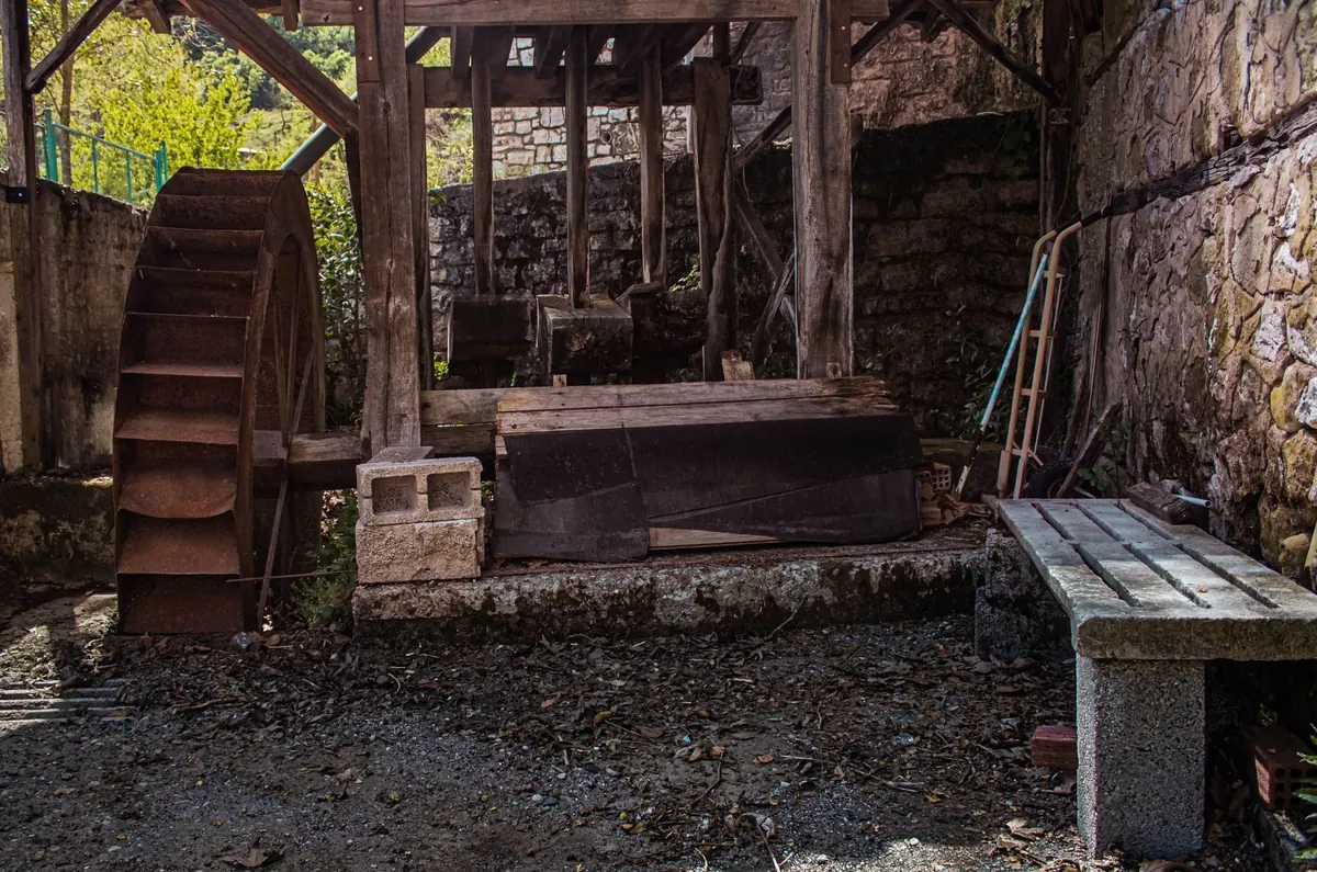
- Weirs and mill races: evidence of water power and old milling rights.
- Lock flights: engineered to lift boats between different river and canal levels.
- Wharf walls: stone edges where goods were loaded and unloaded.
- Roving bridges: built so a towing horse could cross without being unhitched from its barge.
- Sluices and stanking gear: the machinery that held levels up and kept floods in check.
- Tall, narrow warehouses: storage built close to the water, now often homes or restaurants.
Steam, Decline, and the Quiet Years
Railways changed everything. From the 1840s and 1850s, trains took the coal, timber, and general freight that had once travelled by water. Canal and river trade thinned, then stopped. Wharves silted up. Mills closed or switched to steam and then electricity. The Avon reverted to something closer to what it had been before the navigation: a local river, useful for fishing and little else in commercial terms.
That decline is, oddly, the reason so much survives. Nothing was modernised because nothing was worth modernising. Lock chambers, wharf walls, and the line of the towpath stayed roughly where the barge crews left them. A walk along the Avon today still has the bones of a working waterway underfoot.
The river's quietest decades were its most generous: what industry abandoned, walkers and boaters inherited.
Recreation Returns: Rowing, Boats, and the Riverside Walk
Rowing clubs arrived in the 19th century and never left. The river's straight stretches and its wide meadow reach suit eights and single sculls alike, and early-morning crews are now as much a part of the scene as the swans. Below Clopton Bridge, hire boats and motor cruisers take visitors downstream towards the locks at Luddington and Bidford, where the Avon turns properly rural, and upstream past Alveston and Charlecote.
Paddleboarding, canoeing, and open-water swimming have joined the older pursuits, and angling never went away. The towpath, once a route for horses hauling barges, is now one of the town's busiest footpaths. The Recreation Ground and Bancroft Gardens do exactly what their Victorian founders intended: give the town a piece of river to sit beside.
The banks have been reshaped for this second life. Terraces, benches, moorings, and flood defences now line stretches that once held coal heaps and timber stacks. The Royal Shakespeare Theatre's riverside frontage, rebuilt and reopened in the 2000s, put the river back at the centre of the town's identity rather than at its edge.
A Timeline at a Glance
- Roman era: a ford carries a road across the Avon and gives the settlement its name.
- 1196: a market charter turns a village into a trading town.
- Late 15th century: Hugh Clopton funds the stone bridge that still carries traffic.
- 1564: Shakespeare is born into a riverside market town.
- 17th century: the Avon is made navigable; barges bring coal and take away grain.
- 1816: the Stratford-upon-Avon Canal opens, linking the town to Birmingham.
- 1840s onward: railways take the freight and river trade declines.
- 19th–20th centuries: rowing, boating, and riverside pleasure grounds take over.
- Today: kayaks, paddleboards, hire boats, and walkers share the water with wildlife.
Reading the River: Practical Notes for Visitors
You do not need a guidebook to see the trade history, but a few habits help. Walk the towpath in both directions from Clopton Bridge: upstream past the theatre and the Recreation Ground, downstream towards the canal basin and the locks. Look at the water's edge, not the water. Where the bank is walled rather than grassy, someone was loading or unloading. Where the path is wide and flat beside a narrow channel, horses probably towed there.
- Start at the canal basin for the clearest surviving picture of interchange between canal and river.
- Cross Clopton Bridge on foot and look back downstream for the best view of the arches.
- Watch the weir pools for herons, cormorants, and the swirl of water that once turned mill wheels.
- Check river levels before hiring a boat; the Avon rises quickly after rain in its Cotswold headwaters.
The Avon has done almost everything a river can be asked to do for a town: it fed it, powered it, drained it, connected it, and finally entertained it. Walk it slowly and the sequence is still legible, from mill race to mooring, from coal wharf to café terrace. The barges have gone. The shape they left behind has not.
Photo: fotofan1 / Pixabay